 |
||||||||||||||
SERVICE
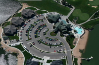
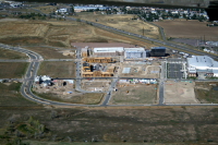
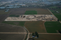
Call us today to schedule your aerial service. 303-641-9528, or email: debbie@cruik.org We at Colorado Aerial Photography has what it takes to get the job done, and give you the very best photographic result!! The two primary image processes of Aerial Photography are known as Oblique and Vertical .
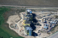
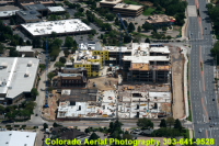
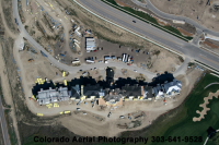
High Oblique are taken at 4000-10,000 feet above ground level. (AGL) Low Oblique are usually taken from 1000-4000 feet above ground level (AGL)
Note: Neither Oblique or Vertical images are to architectural or engineering scale. On-Site Photography is available. This offers photography at the on-site location for ground level views. WE ARE THE ONE STOP SOURCE FOR ALL YOUR PHOTOGRAPHIC NEEDS! Call us today for a quote. |
WWW.COLORADOAERIAL.COM
303-641-9528
Images
copyright protected © Colorado Aerial Photography, LLC
All Rights Reserved
Hope you enjoyed browsing.
The resolution of all images on this site have been reduced for web viewing.
Hope you enjoyed browsing.
The resolution of all images on this site have been reduced for web viewing.